| PROJECT NAME: | Houston’s Bike Plan safe bike infrastructure horizon. |
| LOCATION: | Houston, TX, US. |
| OPENING DATE: | 2019 – 2020. |
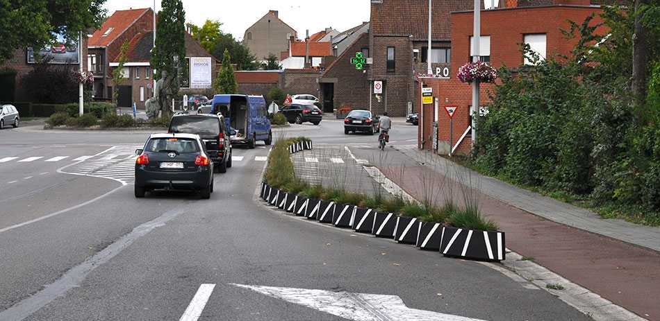
Houston’s Bike Plan identifies 1,800 miles of streets that are considered “short-term opportunities”. According to the bike plan, short-term opportunities are relatively low-cost projects that can be implemented by simply repainting lines and installing bike lane separators on the roadway to create high-comfort bike ways.
Need and objectives of the project.
Houston, Texas, is a city dominated by cars. Cycling has never been a true alternative to the use of private cars because of reckless driving and a lack of protected bike infrastructure, which has historically made it unsafe to take a bike.
The objectives of Houston’s Bike Plan are:
- To improve safety for people of all ages and abilities through improved facilities.
- To increase access to create a highly accessible, citywide network of comfortable bike facilities and increase ridership.
- To increase ridership to exceed average ridership levels in similar cities by implementing policies and programs that enable more people to ride bicycles and encourage healthy, active transportation choices.
The proposed solution.

For this purpose, the city of Houston has relied on ZICLA’s Zebra® 13 separators, which offer a great performance on high-traffic areas, such as the ones in which it has been installed.
During 2019, the Zebra® 13 separators have been installed along 20 miles of streets, as follows:
- Lyons Avenue, 0.8 miles
- Burnett Street, 0.6 miles
- Hardy and Elysian Avenue, 11 miles
- Kelley Avenue, 2.6 miles
- Hunting Bayou, 0.7 miles
- Wheeler Avenue, 1.2 miles
- North Austin Avenue, 1.5 miles
- Brays Street, 0.5 miles
- South Hutchins Avenue, 1.1 miles